Site is Loading, Please wait...
Connected Intelligence for Forests, Industries, and Critical Stakeholders

Connected Smart Ecosystems

Forested landscapes are transformed into digitally connected ecosystems through continuous environmental monitoring. Sensor networks and autonomous drones operate together to detect anomalies, relay real-time data, and maintain uninterrupted ecological awareness. This steady flow of information creates a live understanding of forest conditions, making risk patterns observable as they develop. As conditions change, a clearer operational picture is generated, supporting more informed land and resource management practices across large and remote environments.

Infrastructure & Utility Protection

Critical infrastructure such as power transmission lines, pipelines, and transportation corridors is monitored continuously to identify early-stage wildfire threats. Changes in surrounding environmental conditions are detected automatically, triggering alerts before risks escalate. This proactive monitoring approach reduces exposure to fire-related disruptions and strengthens operational resilience. By identifying potential hazards in advance, essential assets and nearby communities are protected from the cascading effects of uncontrolled wildfire activity.

Environmental Monitoring & Risk Forecasting

Environmental conditions across forests and natural landscapes are captured through long-term sensor data collection. Trends in temperature, humidity, gases, smoke, and particulates are analyzed by AI models to forecast periods of elevated wildfire risk. As climate-driven changes shape the environment, ecosystem health becomes easier to observe and quantify. This continuous data record supports improved decision-making, offering measurable insight into evolving conditions and enabling more strategic planning for land stewardship and fire resilience.

Autonomous Drone Fire Verification

When potential fire activity is detected, autonomous drones are deployed to investigate remote or inaccessible terrain without human intervention. These aircraft gather thermal and optical imagery, verify the presence of fire, and return precise location data. Roadless, mountainous, or hazardous areas are surveyed efficiently from the air, ensuring confirmation can occur even when ground access is limited or unsafe. By providing accurate situational intelligence, these drones help streamline the early stages of wildfire response.

AI-Powered Fire Localization

The exact ignition point of a wildfire is determined by combining sensor data, drone imagery, and terrain information through advanced AI analysis. This fusion of data dramatically reduces the time needed to pinpoint a fire’s origin, especially in smoke-obscured or low-visibility conditions. With precise coordinates generated automatically, response resources can be deployed more efficiently. Faster localization supports earlier containment efforts, ultimately lowering the environmental and economic impact of emerging fire events.

Real-Time Wildfire Intelligence Platform

The Real-Time Wildfire Intelligence Platform consolidates all sensor and drone data into a unified operational dashboard, producing continuous situational awareness across large and remote territories.
Key capabilities include:

  • Live visualization of sensor networks, detection events, and fire locations

  • utomated alerts delivered through email, SMS, and integrated APIs

  • Instant access to thermal, visual, and environmental data streams

  • Centralized management of all wildfire incidents in one interface

  • Long-term data storage for trend analysis and environmental reporting

  • Scalable architecture adaptable to various industries and land types

  • Full white-label customization to align with organizational branding.

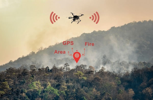
EnviroGrid is a modular environmental intelligence platform combining ground sensors, mesh connectivity, and live geospatial mapping to enable early wildfire detection, real-time monitoring, and infrastructure-grade decision support.

Get In Touch

© 2025 All Rights Reserved.